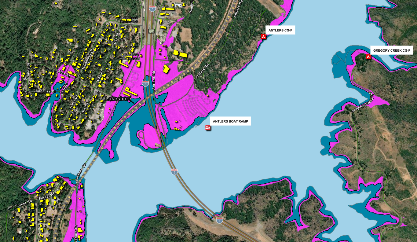
Raising Shasta Dam Map
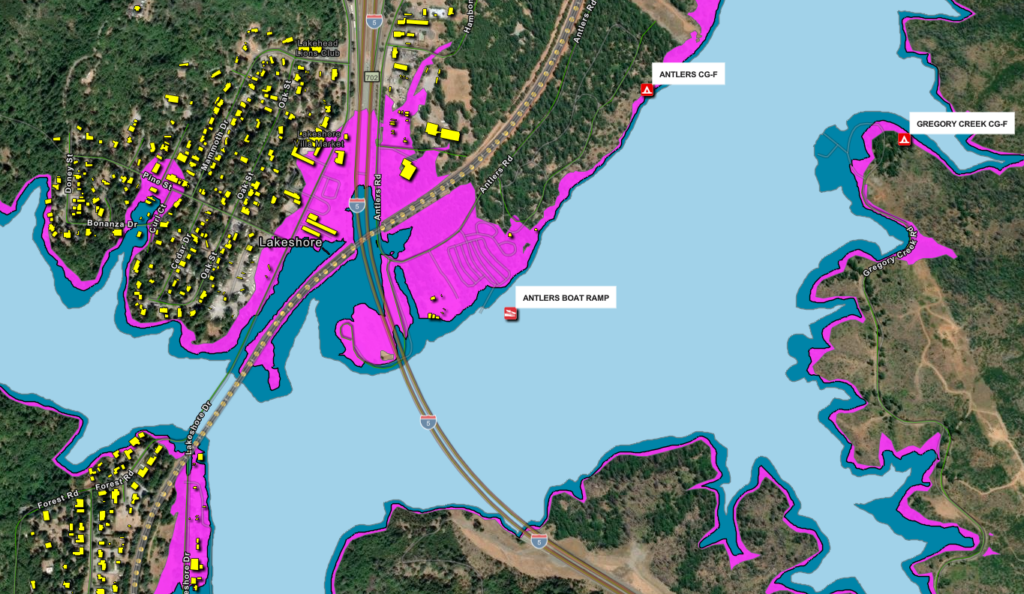
We’ve updated our Raising Shasta Dam webpage with a new interactive map to show how the reservoir would change if the dam is raised. The current full pool is shown in light blue, while the proposed higher full pool is shown in darker blue. The magenta line marks the additional area that could be taken or impacted by the project, extending beyond the water’s edge to account for shoreline changes and operational needs. Check it out!