Redding Riverfront Plan
The Redding Riverfront Specific Plan is a regulatory document that controls what can be built, where it can be built, and what land must remain protected along roughly 380 acres of the Sacramento River. It replaces a framework from the early 1990s and functions as the rule set for both public and private land in the river corridor.
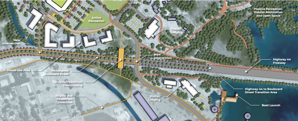
The corridor is divided by Highway 44, which functions as both a physical barrier and an organizing line between two distinct planning areas.
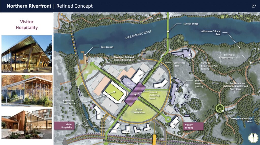
North of the highway, the plan concentrates major public land uses around the Civic Auditorium and Rodeo Grounds. These areas are treated as flexible civic and event spaces, with infrastructure changes focused on consolidating access and reorganizing circulation. This includes redesigning road access, addressing parking and support facilities, and making long-term determinations about whether existing civic venues are maintained separately or replaced with a consolidated facility approach.
This northern zone also includes formal Indigenous cultural protections developed with Tawaw Architecture Collaborative. These protections identify specific areas where development is not allowed due to known or likely burial and sacred sites. It also establishes a formal role for tribal involvement in riverfront land management, including vegetation and habitat work, shifting parts of stewardship away from the city alone.
South of Highway 44, the plan shifts to a denser urban redevelopment model along Park Marina Drive and toward Cypress Avenue. This area is intended to absorb new housing and commercial growth at a fixed intensity of about 8 units per acre, with required ground-floor commercial space built into residential projects to prevent purely residential development.
Although this is framed as “mixed-use walkability,” the design standards are highly prescriptive. Building form is controlled through fixed lot sizes, narrow width ranges, uniform setbacks on all sides, and a 45-foot height cap, effectively defining a very specific built form along the corridor.
The plan also forces a redesign of Park Marina Drive. The city presents multiple road options, but they fall into two categories: vehicle priority designs that keep wider lanes and more traffic capacity, and pedestrian priority designs that reduce vehicle space to widen sidewalks and add separated bike infrastructure. Choosing one or the other directly changes how much space is allocated to cars versus public movement.
Across the entire corridor, the Sacramento River edge is placed under a 150-foot no-build buffer. Several existing buildings already sit within this area, and they are allowed to remain under grandfathered use. The rule restricts new construction, expansion, or redevelopment within the 150-foot zone.
Major unresolved conflict in the plan centers on transportation. Proposals to connect the north and south riverfront areas across Highway 44 require either new crossings or grade-separated infrastructure, but these are expensive, politically contested, and tied to Caltrans jurisdiction. At the same time, redesigning Highway 44 itself into a more urban street is acknowledged, but remains uncertain due to traffic capacity and emergency evacuation concerns.
Overall, the plan establishes a long-term regulatory framework that will reshape land value, restrict shoreline development, redefine housing patterns, and determine how movement through the river corridor functions for decades.
Action Alert: Public Comment on the Redding Riverfront Plan
The City of Redding has started a formal process to decide what will be studied…
Watershed Moment: The Future of the Redding Riverfront
At the May 20th City Council meeting, Redding advanced the draft Riverfront Specific Plan, moving…
Redding Riverfront Project Update Dec. 2024
Presentation to City Council The project team will be presenting a major update on the…
Take Action: Redding Riverfront Specific Plan
The City of Redding recently held two community meetings with the consulting firm MIG to…
Final General Plan Update (April 2024)
As expected, on a 3-to-2 vote, the Redding City Council passed a weak general plan…
Redding General Plan Update
At the February 27th Redding Planning Commission meeting on the Redding Final EIR and draft…